 |
|||||||||||||||||
 |
|||||||||||||||||
 |
|||||||||||||||||
|
|
The Swedish time |
||||||||||||||||
|
|
|||||||||||||||||
|
|||||||||||||||||
|
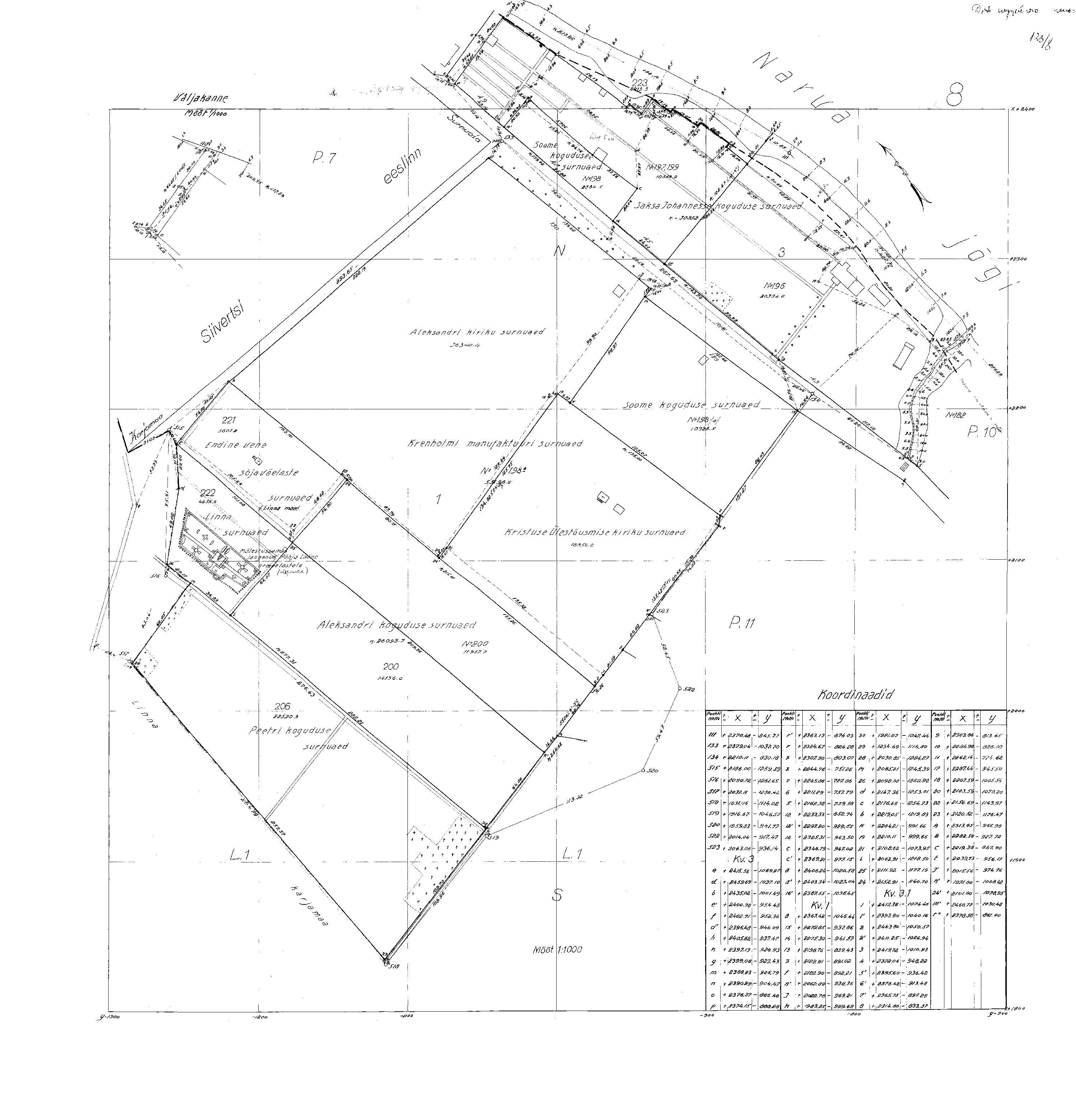
Early maps of Narva |
Maps in format PDF1634 (PDF) |
||||||||||||||||
|
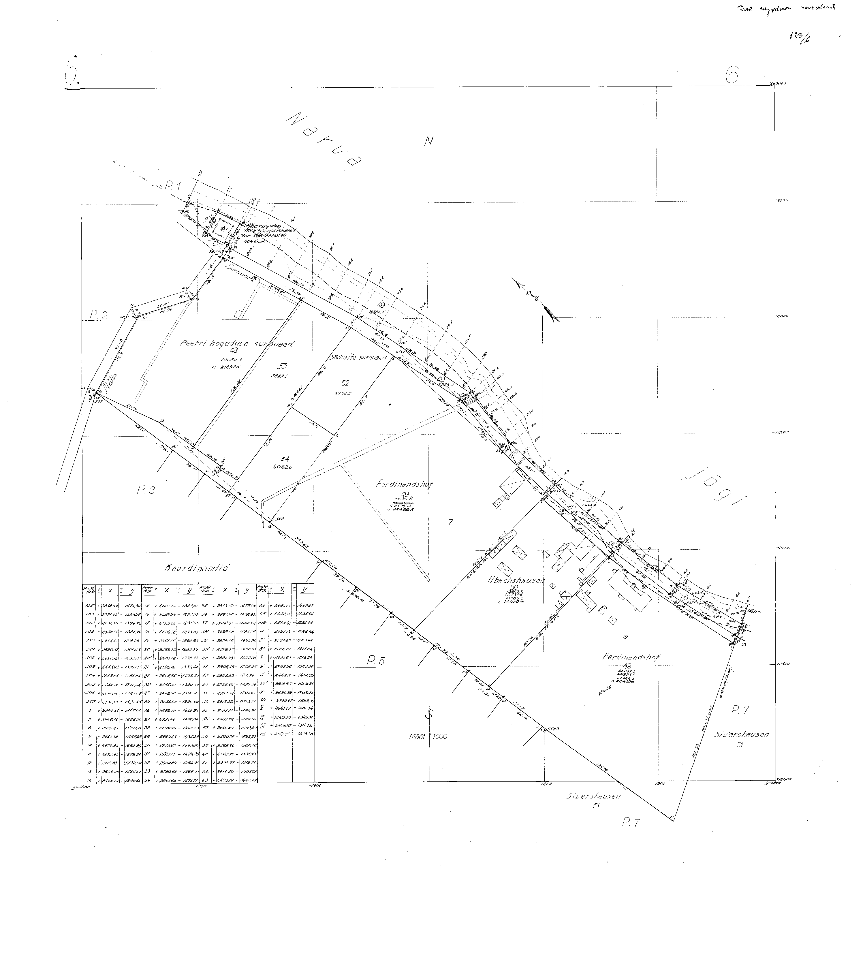
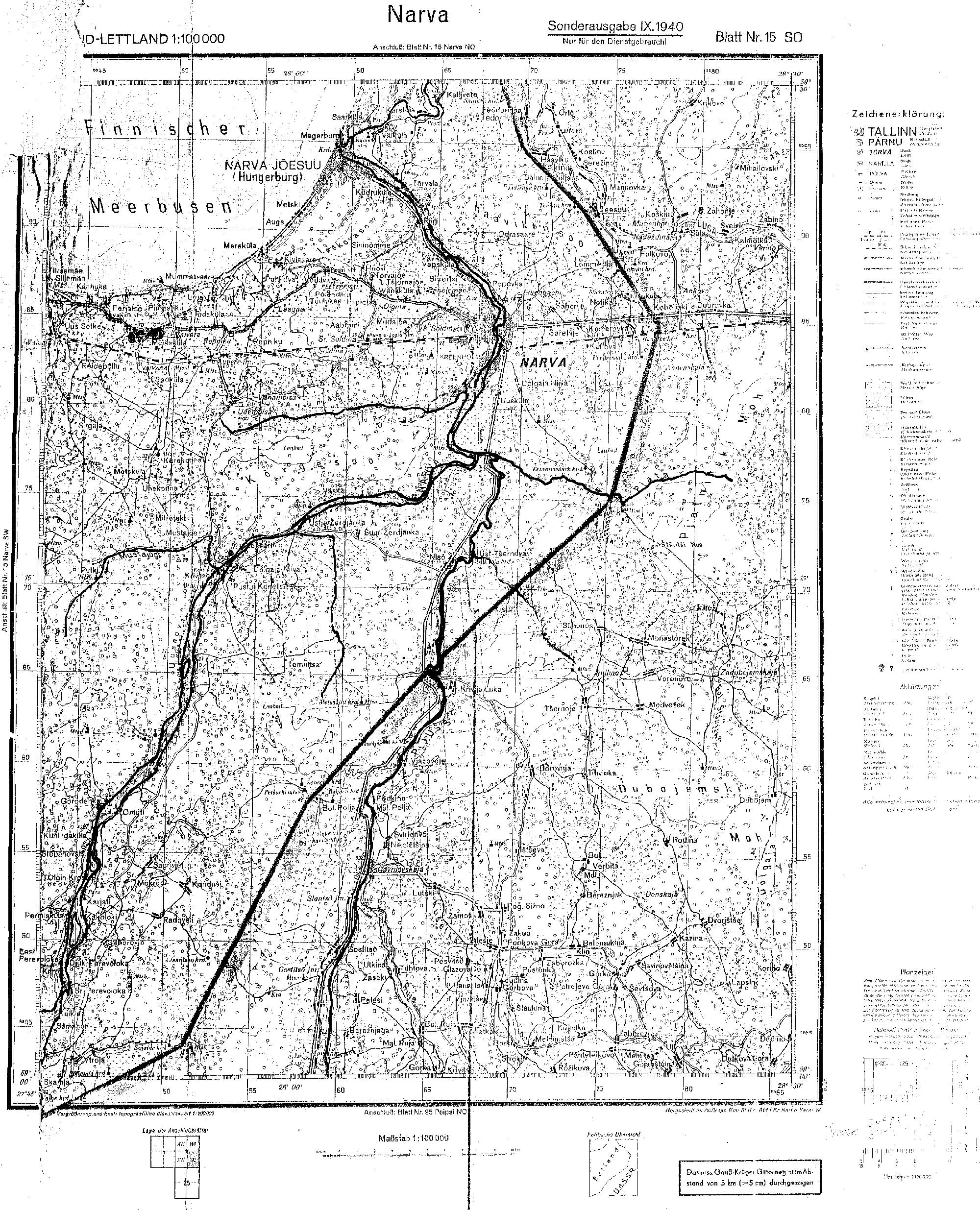
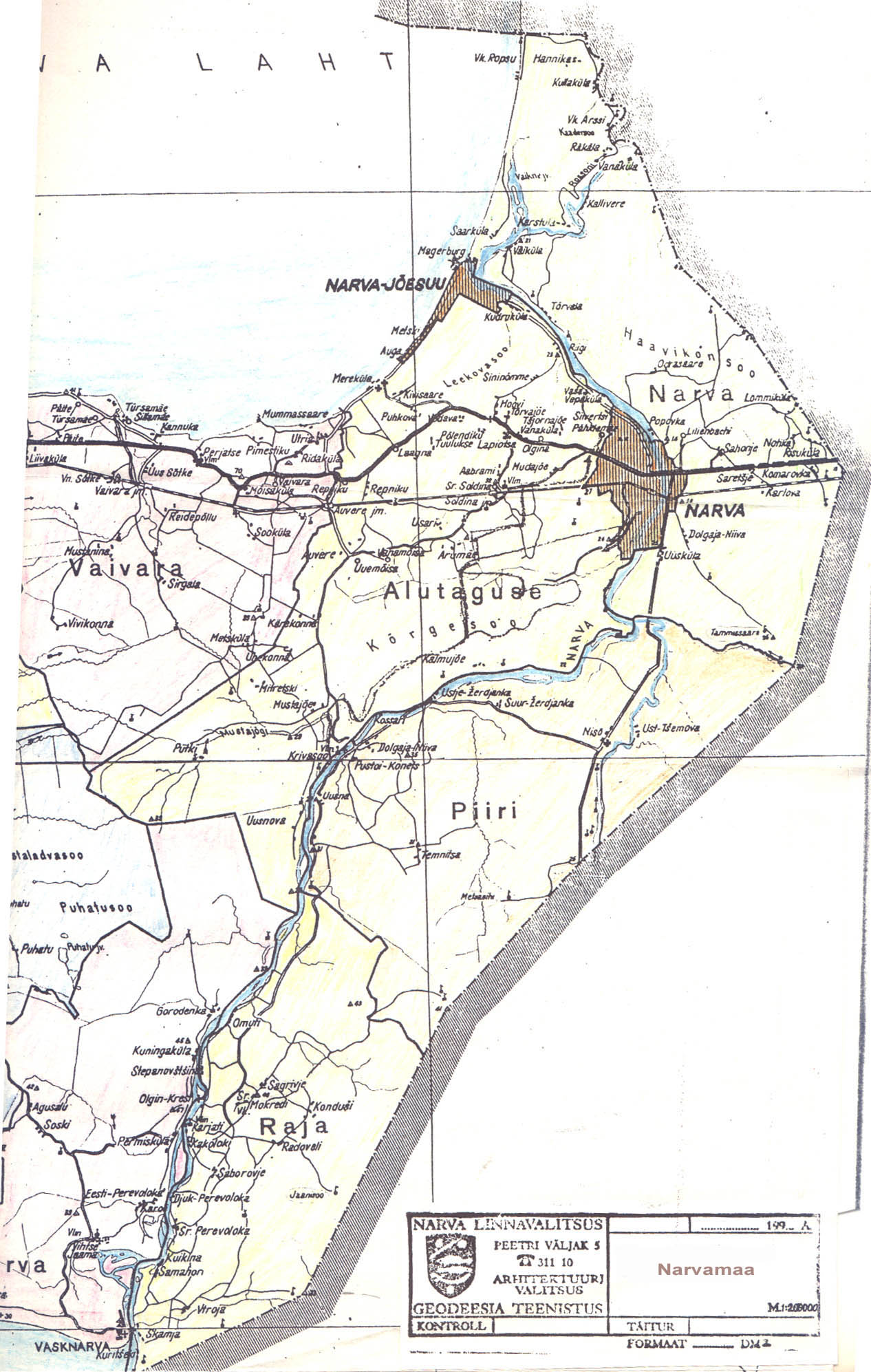
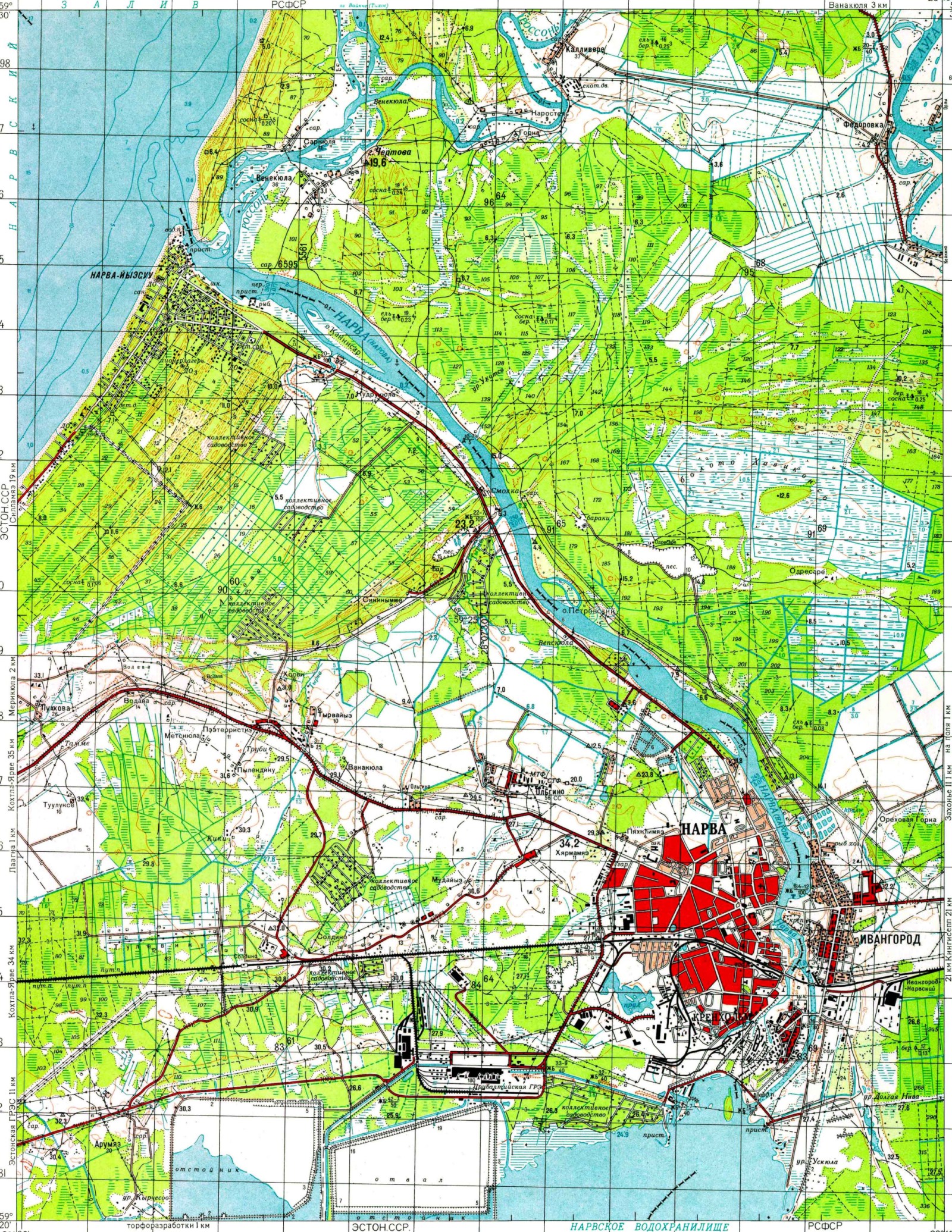
Narva maps of past century. |
|||||||||||||||||
|
|
|||||||||||||||||
|
|
|||||||||||||||||
|
|||||||||||||||||
|
|
The Swedish time |
||||||||||||||||
|
|
|||||||||||||||||
|
|
|||||||||||||||||
|
Early maps of Narva |
Maps in format PDF1634 (PDF) |
||||||||||||||||
|
Narva maps of past century. |
|||||||||||||||||
| The master plan | Detail plans | Architectural competition | Photo gallery | The building charter of city| Geodesy | Map | Contact | |
|
© 2003 Arhitektuuri ja Linnaplaneerimise Amet. Phone +372 35 99050 |
