
![]() Reports of geodetic
works of
2000
Reports of geodetic
works of
2000
![]() Reports of geodetic
works of 2001
Reports of geodetic
works of 2001
![]() Reports of geodetic
works of 2002
Reports of geodetic
works of 2002
Please set problems by mail > alex@narvaplan.ee
or ph. +372 35 99052
Geodesics and
cartographic
The main objectives are detecting the needs and the present situation of
the mapping and surveying of the administrative territory of Narva and
proceeding from that elaborating and executing the development plan of geodesics
and cartographics of Narva; ordering the topographical, geodetical,
cartographical and land survey works and providing the initial conditions for
the works.
Concluding contracts, as well as organising the expertise, accomplishment,
control and admitting of the concluded works.
Issuing the permissions for doing topographical, geodetical and
cartographical works and keeping the register and cartogram, as well as keeping
the main geodetical network and the red line register and plan.
Organising the necessary works for supervising (including safeguarding
the preserving of signs), reconstructing and condensating the geodetical network,
organising the producing, completing and renewing the topographical and
thematical maps and plans.
Giving out initial data and initial materials for compiling the technical
projects of topographical and geodetical works and organising the examining,
expertise and approving (authorising) the projects.
Formation of the administrative boundaries and registered immovables (lots)
of the city and city districts and organising the survey, keeping the records of
the administrative boundaries and registered immovables, keeping the land
register records and the land register map.
Organising the subscription works and actual surveys, keeping the plan of
the utility network.
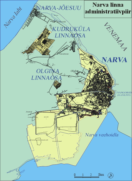
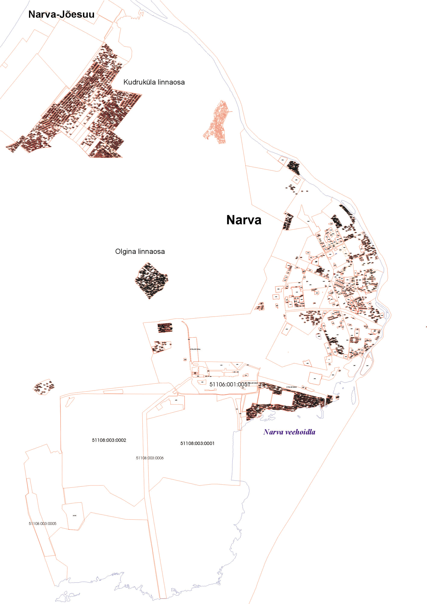
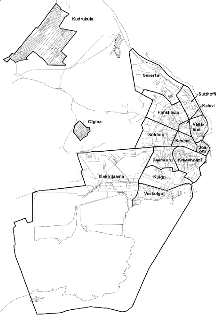
The total area of the city of Narva is 84,001,505 m2 (8,400 ha) and it
consists of three parts - the city of Narva itself enfolds 6,204 ha (without the
territory of the reservoir), the Kudruküla district enfolds 560 ha, the
gardening associations 'Oglinski' and 'Berjozka' enfold 58.15 ha. (file
in .jpg format 0.5 MB)
Till
1992 in a city structure of Narva there was a resort Narva-Jõesuu
![]() (fail formaadis
PDF).
(fail formaadis
PDF).
Narva Arhitektuuri ja Linna Planeerimise Amet (the
Office of Architecture and City Planning of Narva) has the catalogue of
polygonometrical vertices, where 688 special signs of polygonometrics can be
found. The given catalogue safeguards the thriving of the topogeodetical and
catastre works. (file in .xls format 0.4 MB)
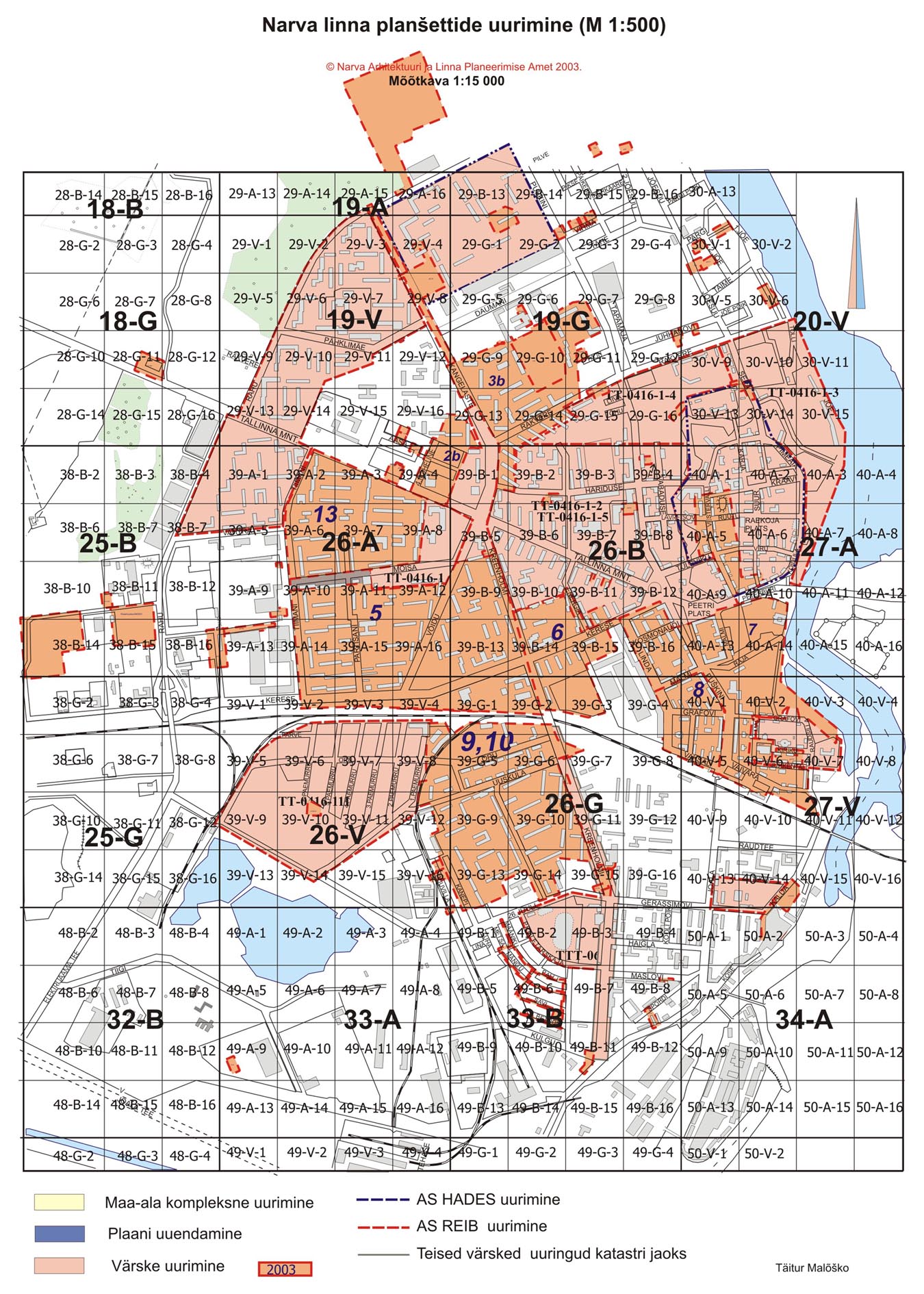
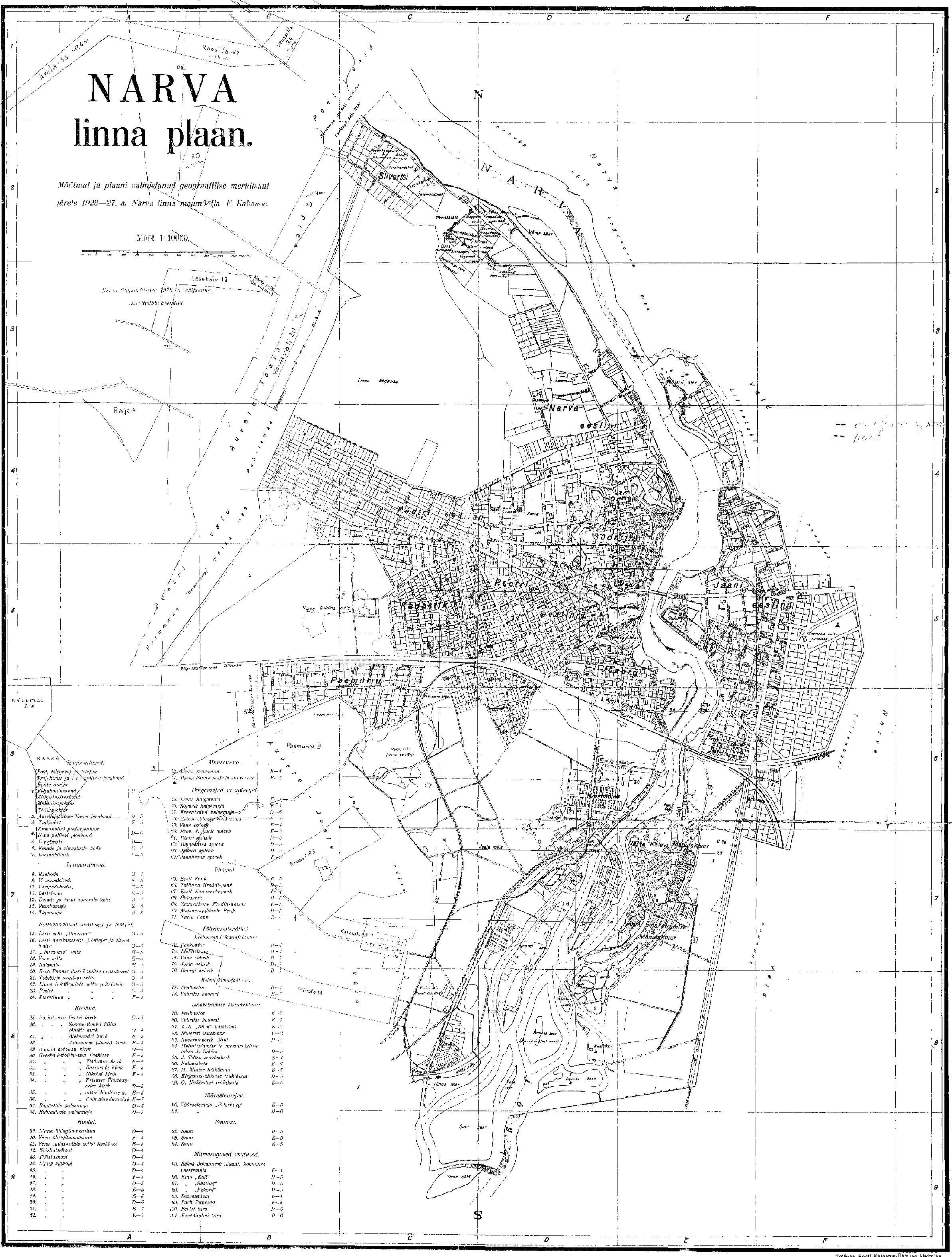
The geodetical survey works shall be entered on planshets on a hard
or soft base, which shall be continuously renewed, the scale of it being 1 :
500. There are 876 planchets of this kind in the archives. In addition to that
there can be found approximately 1730 articles of materials with topographical
content in the archives. For example, the list of reports of geodetic works of
2000. The scheme planchets of Narva ![]() (PDF)
(PDF)
The survey performed in the city during the last few
years is available also digitally. Today, about 70% of the city territory is
covered with digital mapping. (fail in .jpg format
0.5 MB)
The order of performing the works is regulated by the Government
regulation number 303 dating back to 29 August 1995 and confirmed by the
regulation of the city Government of Narva number 949 dating back to 5 April
2000. (file in .doc format 0.5 MB)
Shall it be reminded that the topographical works can be performe only
the licensed specialists (list of names). For applying for the license a
pertinent form has to be filled (file in .rtf format)
as well as the form of performing the catastral works (file
in .rtf format).
In addition to topogeodetical works that are used in planning and
projecting works, the city also has the plans of catastral units that are needed
for secluding the land units. Today (19 October 2001) there are 6900 units
(2411 ha) in Narva that are entered to the land catastre. That constitutes about
35% of the total territory of the city. You can familiarise yourselves with the
land units entered to the catastre (file in .jpg
format 0.4 MB). For the projectors and surveyors
![]() (zip
file in .dwg format 1 MB).
(zip
file in .dwg format 1 MB).
Now in city Narva the following names parts of city are authorized according to
the law on the local names: Siivertsi, Sutthoffi,
Pähklimäe, Kalevi, Vanalinn, Joaorg, Kerese, Soldino, Kreenholmi, Paemurru,
Kulgu, Veekulgu ja Elektrijaama (file
in .jpg format 0.1 MB). Till 2002 the city was divided into 16 micro
districts. In 1940 Narva was divided as follows: Südalinn (the
City Centre), Kreenholm district, Siivertsi, Kadastiku, Paemurru and Jaanilinn. (file
in .jpg format 0,4 MB)
Conclusion
Hence Narva consists of three parts - the city if Narva, Kudruküla and
Olgini district.
The total area of the city of Narva is 84,001,505 m2 (8,400 ha), there are 123 streets in Narva, of which 23 are either renamed or the former name has been restored. In the gardening association of Narva there are 233 streets. The list of the street names of Narva.